 Batch Batch
 Home Home
|
Metadata++ - Batch - Geotagging
|
|
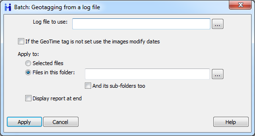
Geotagging from an external lof file.
Geotagging is the process of adding geographical identification metadata to various files such as photos or videos.
It provides location-specific statistics, like latitude and longitude coordinates, plus altitude, distance and even location names when applicable.
This batch adds GPS tags to images based on data from a GPS log file.
Different track log file formats are recognized:
GPS/IMU (.csv)
GPS eXchange Format (.gpx)
International Gliding Commission (.igc)
Keyhole Markup Language (.kml)
Bramor gEO log (.log)
National Marine Electronics Association (.nmea)
Training Center XML (.tcx)
Winplus Beacon (.txt)
If the GeoTime tag is not set use the images modify dates
This will set the GeoTime tag to the file modify date, which is typically when the file was created.
|
Metadata++ User guide
Copyright Jean Piquemal 2020. All rights reserved.
This edition was produced on July 03th 2020.
|